


Aerial inspections using a drone by Falcon.3D - Dubai
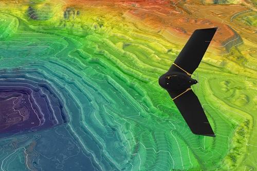
Track, map, survey, inspect, and manage your worksite projects with Falcon.3D. They have professional experts for drone thermal inspection, aerial thermal inspection, and aerial drone surveying with highly specialist pilot companies. Falcon.3D team uses drone mapping to conduct an aerial thermal inspection and generates highly accurate topographic maps of centimetre-level accuracy.
Their aim is to provide accurate and reliable aerial drone surveying services in UAE to esteemed entities in the government and private sectors via aerial surveying for the purpose of land management & development, stockpile volumetric measurements, and land slope monitoring, mapping greenfield projects, designing smart cities, and much more.
Contact Details:
Suite #209, Apricot Tower, Dubai Silicon Oasis
P.O. Box: 238544, Dubai
United Arab Emirates
Call: 97143886888
Email: info@falconsurveyme.com
Visit: https://www.falcon3dme.com/Aerial-Surveys-Mapping.html
It is NOT ok to contact this poster with other commercial interests.


